Monday, March 1, 2010

Site 2

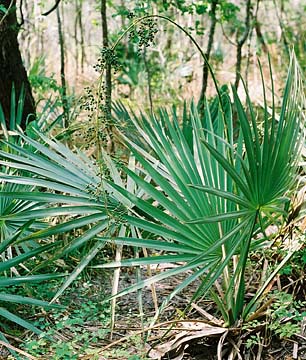
Site 2 is an swampy area containing bald cypress trees and dwarf palmettos


Sign for "The Flooded Forest"


Sign for "Dwarf Palmettos"

Baldcypress Tress

Along the Bayou Coquille Trail, we encountered the Baldcypress, which is a long-lived, deciduous wetland species that grows along rivers, streams, and creeks as well as in swamps with slow moving water. It can live up to 600 years old. It is a legendary tree of the Deep South and most known for its "knees," moss-draped crown, and buttressed trunk. "Knees" of the baldcypress root systems when they are growing in water. They are cone-shaped extensions of the root sticking out from the ground. They are thought to function as the trees' means of obtaining oxygen for the roots during flooded conditions.
Baldcypress trees occur in the coastal plains along the Gulf and the Atlantic Ocean and north up through the Mississippi River Valley. It is a very important tree in the swampland ecosystem. It is valuable for wildlife food and cover. Old-growth baldcypress has a flattened crown usually dangling with Spanish moss. Some river edges still have stumps of giant cypress trees that were logged in the early 1900s.


Wednesday, February 24, 2010

Approaching Site#1 C.F.

Another picture of the open field we saw while approaching the Site#1.

Images near Site#1 K.S.

This was a pictured taken as we were approaching Site #1. We took it because of the random strip of green marshland in the middle.

Site 1 - Enviromental Science - Jean Lafitte National Historical Park and Preserve

Site One - Located on the Marsh Overlook Trail (0.4 miles)


Standing out on the ledge you can gaze as far as the eye can see out into the marsh field. In some places it almost looks like solid ground but it is a marsh; low-lying wet land with grassy vegetation; which is usually a transition zone between land and water.

Looking straight down into the water from the ledge you can clearly see that though the trail travels no farther, the park does.


This is where we did our first set of water and soil testing of the Jean Lafitte National Historical Park and Preserve. We are students from Thomas Jefferson Senior High School. On Wednesday, February 9, 2010, we took a field trip to Jean Lafitte National Historical Park and Preserve where we observed the ecosystem along The Bayou Coquille Trail which leads on heading of Southwest for almost a half mile.

In the water we tested Coliform Bacteria, Dissolved Oxygen, Nitrates, pH, Phosphates, Salinity, and Turbidity.


In the soil we tested Soil pH, Nitrogen, Phosphorus, and Potassium (Potash).


Ellie Landry (February 24, 2010)

Site 1 water test results

The temperature of test site 1 was 10.5 degrees Celsius. When we preformed the test the water temperature was 17 degrees Celsius. After testing site one we came to conclude these are the results for each test. Coliform Bacteria test + and had a dark yellow color which provide the results of the test. For out dissolved oxygen test we concluded results that proved to be 0 ppm. These results have a high chance of inaccuracy unfortunately due to the fact that we preformed the test at the lab instead of on location. Walking with the water in a container could have possibly released O2 gases from the water. When testing for Nitrate our results also showed 0 ppm at this site. Our pH test showed a pH level of 7 showing a greenish color in the test tube. Both the phosphates and salinity of the water tested for 0 ppm and the turbidity of the water was 0 JTU.

Site 1 soil test results.

When we preformed our test for soils we concluded these results. For pH we came to the result that the soil has a pH level of 7 showing as a blueish color. When testing for potassium the traces were very low about 0-120 lbs/acre. On the other hand Phosphorous traces were high, around +100 lbs/acre. Lastly Nitrogen was very low and merely a trace only around 0-30 lbs/acre showing up light pink in the test tube.


Eric Vickers (February 24, 2010)


Friday, February 19, 2010

Water Hardness

Our AP Chemistry class went to Jean Lafitte park to explore and collect several species of plants and take samples of water at different locations. At each site, we collected at least 50 mL of water in three different cups. The difference in the sites was that they were each at different parts of the marsh so we could find if the hardness was affected by its location. After collecting all the samples we needed, we headed back to the lab and began our testing. To begin testing, we put 50 mL of each sample into individual beakers and tested them separately to compare. Next, we filled a burette pipette with 25 mL of EDTA solution and sat it above the beaker. Then, we added 10 mL of buffer to each sample, then we added 5 drops of indicator that made the solution turn a slight purple. Next, we began to allow the burette to slowly drip out into the beaker and we observed how many drops it took to change the solution color to blue. The more drops it took, the harder the water sample was. It wound up coming out that the hardness of water didn’t change a lot by the location of the water.

introduction

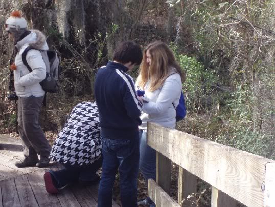
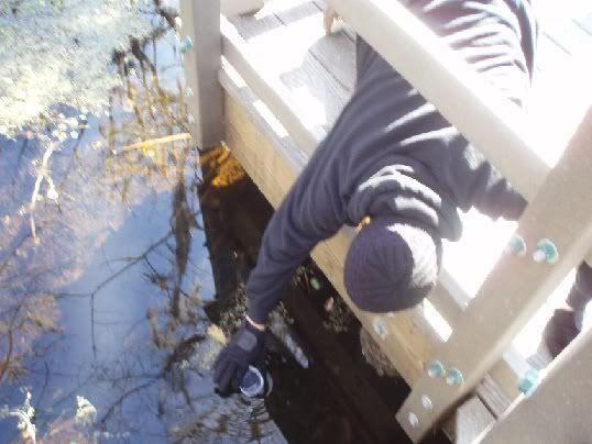
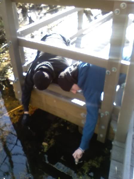
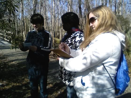
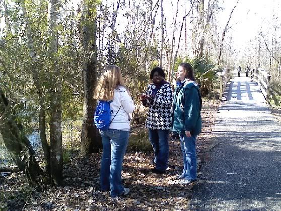
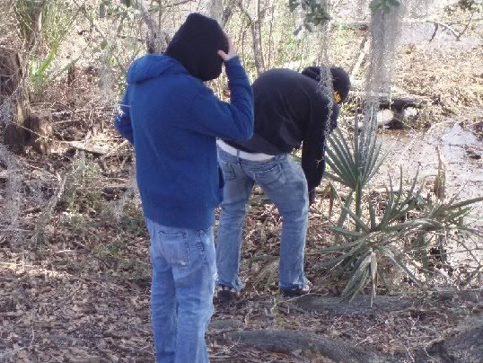
The students of Thomas Jefferson High School enrolled in the AP Environmental Science course recently went on field trip to Jean Lafitte Historical Park and Reserve. While on the field trip our mission was to take a water analysis and soil test for three different sites at the park. The sites where we collected water and soil samples consisted of a freshwater marsh, a cypress swamp, and the Mississippi River Barataria tributary. Using the water samples we extracted, we tested the levels of coliform bacteria, dissolved oxygen, nitrate, pH, phosphate, salinity, and turbidity of each. The soil analysis comprised of a pH, potassium, phosphorus, and nitrogen test.

Thursday, February 18, 2010

The TJHS AP chemistry class has been doing a lot since we visited Jean Lafitte National Historical Park. While in the park, we took different plant and water samples from three different locations. We have been doing tests on the water to check for ions in the water. We have also done test to check for the waters hardness. We compared the hardness of the water from the park to the hardness of the tap water. As for the plants, we have performed chromatography on the different samples. This separates the different components of the plants. We will look further into the chromatography of the plants to see how the different samples are similar and different.

Chromatography of the surrounding plant life.


Chromatography, in this case, was used in the process of extracting pigments from the vegetation we collected from the three sites. The three sites included a variety of plant species such as the palmetto, blackberry bushes, oak trees, wax myrtle, and Spanish moss. We then took these plant samples back to the lab and grinded them up into a fine paste. Next, we took the heated chromatography paper and applied the paste about a half-inch from the bottom of the paper. The chromatography paper was then placed into a chromatography solvent. The solvent’s job is to dissolve the different pigments in the paste and separate its components thus creating the various pigments found on the chromatography papers. In our own experiment, we got a variety of green and brown pigments from the plant life we collected.
Site 1: Marsh Overlook
Time: 9:21 A.M.
Temperature of Water: 11.0ºC
pH of Water: 7.4

Palmetto leaves collected at:
N 29º47.444
W 90º07.815

Blackberry leaves, moss, red berries, red flowers, and wax myrtle leaves:
N 29º47.740
W 90º08.055


Collecting blackberry leaves


Site 2: "Monarch of the Swamp"
N 29º47.531
W 90º07.587
Time: 10:12
Temperature of Water: 10.2ºC
pH of Water: 6.9

Blackberry leaves collected at:
N 29º47.520
W 90º07.616

Hickory leaves, or "bent leaves":
N 29º47.531
W 90º07.592


Collecting water samples


Taking the temperature and pH of the water


Collecting wax myrtle tree leaves


Collecting oak tree leaves


Site 3: Beginning of Trail
N 29º47.625
W 90º07.406
Time: 10:46
Temperature of Water: 9.3ºC
pH of Water: 7.1

Blackberry leaves collected at:
N 29º47.419
W 90º07.406

Oak leaves:
N 29º47.619
W 90º07.407


Collecting water samples

Wednesday, February 10, 2010

It Changes!

As you walk in the trail of Jean Lafitte National Historical Park, you can start to notice that there is less and less trees. The reason for this is that the area is a marsh zone. The echosystem also changes as you walk down the trail. It starts off dry, then as you start to get deeper and deeper, it gets wet and wetter.

#1

The baratarians and Jean Lafitte were pirates in the 1800's that delivered goods and slaves to wealthy plantation owners.

N 29°47.620

W 90°07.416

Point 10

N 29° 47.478
W 90° 07.702

At point #10, we were told to sit and listen to nature. The most prominent sound was the robins and finches chirping. Another sound was the wing rustling the leaves and shaking palmettos. The softest sound was almost like crickets chirping, but we didn't know what it was. When listening to all the sounds together, it takes us to natures own symphany.

Mark 5


The geography theme of human-environment interaction is demonstrated in the use of the Dwarf Palmettos. The Dwarf Palmettos are used to weave baskets and as thatch roofs. The natural levee is formed from sediment that is deposited over thousands of years from the river flooding.

Location #9


There were numerous trees in the setting and there was obvious animal life. This created a peaceful and calming feel to the area. It’s a great place to think and to read various books. With its peaceful mood, we could see that there were many human activities. It had broken trees and rootless grass. There was water all over the place, at some places not visible because of the branches everywhere covering it.

Middens

The leaning tree roots used to be buried in shells from the Native Americans. As the shells were removed, it put pressure on the roots and they began to lean. Artifacts such as projectile heads, pieces of pottery, copper, and clay were found in and among the shells.
Bald Cypress has needle like leaves that grow that appears soft and feathery. The wood is really durable and are abundant in wet swamp siols of floodplains. The Monarch bald cypress tree in Jean Laffite grow abut 100 feet high and is 15 in diameter.
Question 6
The area was mucky and full of water because it is a swamp. There are many Cyprus trees growing out of the dirt in the river with its knees coming out of the water. There were leaves in the water. Some recently fell out of the trees; others were brown because of their death. There were a couple of birds chirping. The wind was blowing the leaves and the water.

The coordinates for the place were: N 29°47.552
W 90°07.560


°


The trip gave us a new sight in nature. We also learned new things such as who Jean Laffiete really was and how Human-Enviroment Interaction was presented in the forest. We were able to use our GPS skills to complete tasks.

Friday, January 15, 2010

Thomas Jefferson High School post 2

Test 1 getting sample
Test 3 dizolved Oxygen

JLNP Project- Arrival and beginning tests


Image 1: (Performing Dissolved oxygen test)
Image 2: Collecting a Water Sample
Image 3: Students Listen to the speaker, a National Park Ranger.


Images 4 and 5: Speaker addresses the students at the JLNP cultural project.

Image 6: The students' first arrival within the park.


Thursday, January 14, 2010

Welcome to our Blog!

The students at Thomas Jefferson High School are participating in a project with Jean Lafitte National Park. Students and teachers will create lessons about the history and culture of the Preserve area that can be shared with others via the NPS website and throughout Jefferson Parish. This blog contains some of the information gathered during the process. Join us as we discover Barataria.